The designed landscape around Copgrove Hall was developed in two major phases. The first was in the 1760s when the lake and southern parkland was put in to a design by Thomas White to complement the old hall. The second was in the third quarter of the 19th century with the development of the parkland north and east, after the present Copgrove Hall was constructed in the 1820s. By the start of the 20th century, the designed landscape covered nearly 400 acres with extensive parkland and plantations, pleasure grounds around the Hall, two icehouses and a large walled kitchen garden. Although some of the parkland has reverted to arable fields and the interior of the kitchen garden has been built over, many plantations and the lake remain providing a suitable setting for Copgrove Hall.
Estate owners
At the beginning of the 13th century, the manor of Copgrove was gifted to the Knights Hospitallers by Ellaria Trusbut (YAS 1921, 38) and they held it until the dissolution of the monasteries in the mid-16th century. In October 1545, the ‘Lordship and Manor of Coppegrave’ was bought by William Ramsden of Longley and the Wyse [or Withes] family (PRO 1907, 325). It remained the possession of the Withes family until the Commonwealth period when it was bought by Sir Thomas Harrison of Allerthorpe (Major 1927, 137) who died in 1664. His son and grandson, both also Thomas, inherited in turn until the latter sold it to his ward, Henry Hodges, in 1713 (NYCRO ZEW1/181). It was bought by Thomas Duncombe in 1742 (ibid) and inherited by his son, Henry, in 1746. Henry Duncombe died in 1818 and was succeeded by his nephew, Thomas, and then by Thomas’ son, Thomas Slingsby Duncombe, who sold the estate the following year to James Brown of Harehills and Rossington Hall.
James Brown died in 1877 and his daughter Mary Shiffner inherited the estate followed by her daughter and son-in-law, Emily and Sir Francis Bridgeman, in 1894. Bridgeman died in 1929, seven years after his wife. The estate was put up for sale by his executors and sold in 1935 to Wilfred Appleyard but he put it back on the market the following year and it was purchased by Major Lionel Holliday, who sold it in 1969. The Hall and 12 acres were purchased by the current owner in 1979.
Key owners responsible for major developments of the designed landscape and dates of their involvement:
Edward Withes c. 1600 - 1622
Thomas Harrison c. 1688 – 1713
Henry Duncombe 1746 – 1818
Thomas Duncombe 1818 – 1847
James Brown 1848 – 1877
Sir Francis and Emily Bridgeman (née Shiffner) c. 1894 - 1929
Early history of the site
Copgrove was a ‘camera’ or subsidiary farm for the Knights Hospitallers in order to fund their activities. In 1338, an audit was undertaken of their possessions and at Copgrove there was (Camden Society 1857, 112): ‘one manor 800 acres of land, six acres of meadow, 20 acres of pasture at an annual rent of 20 marks. And William of Hotham has the aforesaid manor for life, rent free in the time of Thomas Larcher.’ When the estates of the Knights were taken over by Henry VIII, an assessment was made in 1540 and it included the following: capital messuage or manor of Copgrave together with an oxgang (c. 20 acres) of land and meadow with herbage of woods there and 9 closes, a further 36 oxgangs (c. 720 acres) of land and 4 acres of meadow, 7 tenements (groups of buildings), 8 cottages and 2 gardens. The total rent was £17 5s 8d (YAS 1937, 136). This was acquired by Ramsden and the Withes family five years later, together with other lands previously belonging to the Knights, for £1178 4s 7d (PRO 1907, 325).
The Withes family moved to Copgrove although they appeared to continue to own only part of the manor. In 1608, when it was in the possession of Edward Withes, the landscape was described as having ‘three gardens, one flower, one produce and one lush valley garden with flow through stream with two delightful hidden springs one on the south valley side and one at the north west end of the garden. Also on the south side valley…a small sheet of water, various orchards’ (from a letter in a private collection). This description would suggest that the location of the hall was to the west of the walled garden as shown on the tithe map (Figure 1) and that the area that later became the kitchen garden dated from this period.
At some point between 1640 and 1660, Sir Thomas Harrison of Allerthorpe bought the manor of Copgrove. At his death in 1664, he was recorded as being ‘of Copgrove’ in Dugdale’s Visitation of Yorkshire in 1665/6 (Clay 1917, 270). However both his son and then grandson appeared to prefer living at their other estate, as legal documents from 1675 (LUSC YAS MD87/K5 & D5) say the manor house or capital messuage is tenanted by Thomas Wilkes, a yeoman. Sir Thomas Harrison and his heirs had the right to occupy Allerthorpe through his mother, Frances, for eighty years under her brother’s will from 1626 (VCH 1976, 133-40). This entail was challenged unsuccessfully by her great-grandson, Thomas Harrison junior, in 1688 (ibid) and so he made plans to move to Copgrove permanently by the time he had to leave Allerthorpe (c. 1706). In the same year as his court case, he borrowed £2,000 from Sir Richard Franklyn of Moor Park, Herts (NYCRO ZEW1/181). This was possibly to pay for his costs but more likely to pay the debts of his father, who mortgaged Copgrove in 1675 (LUSC YAS MD87/K5 & D5). It may also have paid for the rebuilding of the Hall.
In the hearth tax return of 1672, a John Wilkes is recorded having 7 hearths (TNA E179/210/400 m17), which is presumably the capital messuage of the Withes family. Then it was a relatively modest property that must have been enlarged by Thomas Harrison, as by c. 1720, a sketch by Samuel Buck shows a substantial house (Hall 1979, 245). This is shown in a sketch of a mid-18th century painting (Figure 2). The surroundings were described by John Warburton in his notebook on 12 February 1719: ‘over a causey [causeway] came to Cotgrave [Copgrove], the seat of Henry Hodges esq. Pleasantly situated on a rising ground on the east bank of a neat rivulet, a very neat and regular building of brick’ (YAS 1900, 71). The sketch by Buck shows a courtyard with possible flowerbeds in front surrounded by a wall with a line of trees to the right.
Henry Hodges appears to have had substantial money problems and by 1741 owed his creditors in excess of £10,000 (NYCRO ZEW1/181). Finally on 5 February 1741, a court judgement ordered that he should pay debtors and Hodges agreed to be foreclosed (bankrupted). On 5 May 1742, Thomas Duncombe agreed to purchase Copgrove for £14,500, thereby paying off Hodges’ creditors. It would appear that during this period of ownership by Hodges, little was done either to the Hall or the landscape.
Chronological history of the designed landscape
1766 – 1820
Henry Duncombe had inherited the property from his father in 1746 but it was twenty years later when he decided to radically reshape the landscape. In early 1766, he applied for permission to remove two stretches of highway at Copgrove (TNA C 202/154/18) that was granted on the 29 July. This involved taking out just over half a mile running from the smithy in the village through the recently enclosed ‘Copgrove Moor’ south to ‘Rigg Moor Gate’ (SE 337 628) and also 275 yards from the smithy southeast to ‘Deepdale Gate’ (SE 345 631). This was presumably prompted by an improvement plan drawn up by the landscape designer, Thomas White, who was engaged the following year. Letters to his foreman, William Stones (WYASL WYL100/C23a/44, /107), show that they were making the lake (Turnbull and Wickham 2022, 186-7).
White may also have been responsible for some of the surrounding plantations, including those to the south where the former public road had been. A description of Copgrove from 1785 (Hargrove, 137) mentions them: ‘From most of the rooms of this elegant mansion is a pleasing prospect of the lawn, bounded by hilly grounds, on one side of which a fine sheet of water, bordered with wood, winding out of sight beyond a distant hill, adds greatly to the beauty of the scene’. It seems though Duncombe wanted further work doing as Adam Mickle, another landscape designer, noted in a letter on the 4 August 1786 that he had been at Copgrove and that he is to give a plan of alterations (BA L 30/14/254/3). It is not known though if Mickle carried out any work there.
In addition to the landscaping, Major claimed that the Hall was rebuilt some time before 1785 by John Carr (1922, 67), as the description by Hargrove of the south front says that ‘over the entrance is a pediment, supported by four square pilasters’ (1789, 135). However this feature can be seen in the sketch by Buck (Hall 1979, 245) but it is possible that modifications were made to the building.
Later history
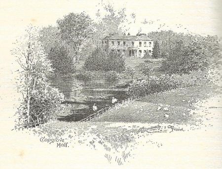
Following Thomas Duncombe’s inheritance from his uncle in 1818, he rebuilt the Hall in 1821 to the north of the old hall (Morning Chronicle, 13 July 1848), added the lodge to the southeast and possibly the bridge over the lake (‘Fish Pond Bridge’). It is unclear as to whether he extended the designed landscape as the map of 1827/8 by Greenwood shows lake and plantation to south but not the parkland to the north and this is confirmed by the tithe map of 1840 (NYCRO T [PR - CPG6-2], Figure 1). The latter also shows that the parkland south of the Church was still fields.
The advertisement to sell the property listed the following:
A large garden, walled round with choice fruit trees; pleasure grounds and plantations adjoining the mansion, which fronts to a spacious lake well stocked with fish, the whole being situated in a splendid park with a lodge entrance, richly wooded and commanding a beautiful and extensive view of the adjoining country…The mansion house was erected by the late Thomas Duncombe Esq. under his own superintendence, and without regard to expense, and it is intended to allot with it about 2,500 acres in order to make the estate and boundary more complete. The estate is occupied by highly respectable tenants.
James Brown bought the property and started to make significant changes to the landscape. By 1852 when the 1st edition 6” OS map was surveyed (Figure 3), more parkland was added to the north (‘Well House Park’) and to the south between the Church and the road leading to the lodge. It also appears that some of the buildings around the walled kitchen garden have been removed. Around the Hall on all sides except the east, there is possibly more planting with the extension of ‘Morcar Wood’.
By 1889, the small walled section to west of kitchen garden had been removed, together with the road next to it and the former Roecliffe Lane (Figure 4). A new bridleway was added from just west of the Church that ran north to a new lodge called ‘Roecliffe Lodge’ (Figure 5). The road north of the lodge from Roecliffe has an avenue of trees leading to it and there is an extension of the parkland to the south of it. To the west the area around Crow Nest and Checkers Carr has also become parkland. An icehouse has been added north of the walled garden by 1889, with a second one in place south of the stables by 1907. In addition to the two free standing glasshouse there by the late 1880s, an additional glasshouse at back of northern wall of kitchen garden has been constructed by 1907.
When the estate was put up for sale in 1925, it was described as:
This well-known county seat, standing in a well-timbered park of 120 acres and enjoying an elevated position on gravel soil with extensive views…finely timbered grounds and garden of 17½ acres, ornamental lake of six acres, undulating lawns, tennis lawns, pergolas and herbaceous borders, matured kitchen garden and good glass[houses]. The 2,600 acres of shooting includes some well-place coverts…a trout stream intersects the estate for three miles. (Country Life, 11 July)
Apart from the walled kitchen garden that now has houses inside it, the rest of the designed landscape remains as green space either as woodland, parkland or arable fields.
Location
Copgrove hall is situated 5.5 miles (9km) northeast of Harrogate and 5 miles (8km) southeast of Ripon.
Area
The historic designed landscape of Copgrove covered 380 acres (154 hectares) at its greatest extent in 1907, see Figure 6.
Boundaries
The northern boundary is marked by Roecliffe lodge with the eastern boundary running south from here along the edge of the parkland until it reaches the public road, Wath lane. Its southern section runs along the parkland from the road to Walkingham until SE 345 625. The southern boundary is formed by the southeast parkland and Dark Walk Wood until Green Lane. The western boundary starts at the eastern edge of dark walk wood then follows the southwest parkland to the toll house. It continues north following the western edge of the parkland at Chequers Carr and the northern sections of well house park to Roecliffe lodge.
Landform
The underlying bedrock is Brotherton formation of limestone. This is overlaid with superficial deposits of clay, sand and gravel. The southern parkland and area around hall have freely draining, slightly acid, loamy soils with low fertility. The northern parkland has slowly permeable seasonally wet acid loamy and clayey soils.
Setting
Copgrove lies in the national characterisation area 30 (southern magnesian limestone). This is a ridge of elevated land running north-south with light, fertile soils. It is mainly open, rolling arable farmland enclosed by hedgerows, plantation woodlands and estate parkland. The watercourses that run through it, such as the one next to Copgrove, provide areas of wetland. The limestone has provided much building material for the many large houses in the area.
Copgrove hall stands on an elevated position at 40m AOD, with the ground sloping down south to the northern edge of the lake at 34m AOD and to the stream to the west and north (27m AOD). To the east, the ground is largely level towards the village and church. The parkland to the north is mainly flat at 25 OD.
Entrances and approaches
Lodge [Grade II, HE list no. 1212706]
Built c. 1821 by Thomas Duncombe at the same time as the construction of the new hall.
Gatepiers [Grade II, HE list no. 1150342]
Built c. 1821 by Thomas Duncombe adjacent to main lodge and providing the southern entrance to the parkland via a carriageway north to Copgrove hall.
Roecliffe lodge
Constructed between 1852 and 1889 at the northern extent of the parkland and the start of a carriageway south to the hall.
Fishpond bridge [Grade II, HE list no 1315382]
At the southern end of the fish pond, its date of construction is uncertain but was in place by 1828 as it is shown on Greenwood’s map.
Principal buildings
Copgrove hall [Grade II, HE list no. 1212710]
Built c. 1821 to the north of the old hall.
Old Copgrove hall
Possibly the original medieval manor house that was acquired in the mid-16th century by the Withes family, it lay due east of the walled kitchen garden. Remodelled in the late 17th century by Thomas Harrison, it may also have been updated by Henry Duncombe in third quarter of 18th century.
Stables
Date of construction unknown but shown on tithe map in current position.
Icehouses
Two icehouses were built due east of the stables in the pleasure grounds. The northern one (SE 34433 63394) is shown on the 1st edition 25” OS map (Figure 4) surveyed in 1889. The southern one (SE 34354 63350) only appears on the revised edition of the 25” OS map.
Boathouse
This is not mentioned in the sales particulars of 1848 but is shown on the 1st edition 6” OS map that was surveyed between 1848 and 1852, so could date from then.
Gardens and pleasure grounds
A description from 1608 of the area around the old hall says there were ‘three gardens’: one for flowers, another a kitchen garden and the third ‘a lush valley garden with stream’. The first two may well have been where the later kitchen garden was located as these areas were shown on the tithe map (areas 7 and 9 respectively on Figure 1). The valley garden was to the west before the fish pond was constructed. When the new hall was built, the site of the former building was landscaped with an area of pleasure grounds and open lawn with further trees and shrubberies to the west between the new building and the stream.
Kitchen garden
The date of construction of the main walled area is unknown but may well date to the early 17th century. By the mid 19th century, it had a slip garden to the south and an adjacent walled enclosure to the east. The latter had been removed by 1889 with two glasshouses being added to the interior of the main section. A third glasshouse on the northern wall was put in by 1907.
Park and plantations
‘The park’ (southern parkland)
The southeastern section of 50 acres was probably part of the redesign of c. 1767 when the fishpond was added. The western part of 18 acres to the north of dark walk wood may also date from this period. The area to the southeast of 26 acres was added c. 1850.
‘Well House park’ (northern parkland)
A small section of this to the west north of the hall may have been in place earlier but the bulk of this parkland of 142 acres dates from c. 1850.
Dark walk wood
Covering 18.5 acres to the south of the lake, this was originally planted in the mid 18th century and extended south in the late 19th century.
Crow wood/Morcar wood
Originally extending to 16 acres on the western side of the stream c. 1850, this was reduced in the late 19th century.
Water
The ‘fish pond’, covering 5 acres, was constructed in 1767 to a design by Thomas White.
Books and articles
Camden Society 1857. The Knights Hospitallers in England. London, J. B. Nichols and Sons.
Clay, J. W. 1917. Dugdale’s Visitation of Yorkshire, Volume III. Exeter, William Pollard & Co.
Hall, I. 1979. Samuel Buck’s Yorkshire Sketchbook. Wakefield, Wakefield Historical Publications.
Hargrove, E. 1789. The history of the castle, town and forest of Knaresborough, with Harrogate, and its medicinal waters, 4th edition. York, W. Blanchard.
Major, H. D. A. 1922. Memorials of Copgrove. Oxford, Basil Blackwell.
PRO 1907. Letters and Papers, Foreign and Domestic, Henry VIII, Volume 20 Part 2. London, HMSO.
VCH 1976. Allerthorpe in A History of the County of York East Riding: Volume 3, Ouse and Derwent Wapentake, and Part of Harthill Wapentake, ed. K J Allison. London, 133-140. (British History Online http://www.british-history.ac.uk/vch/yorks/east/vol3/pp133-140 [accessed 31 May 2022]).
YAS. 1900. Journal in 1718/9 by John Warburton Yorkshire Archaeological Journal 15, 61-84.
YAS. 1921. Record Series Vol. 62: Feet of Fines for the county of York 1218-1231. Leeds, Yorkshire Archaeological Society.
YAS. 1937. Record Series Vol. 94: Miscellanea, Vol IV. Leeds, Yorkshire Archaeological Society.
Primary sources
Bedfordshire Archives (BA)
L 30/14/254/3 Letter from Adam Mickle to Francis Robinson, 4 August 1786
Leeds University Special Collections (LUSC)
YAS MD87/K5 Agreement between Thomas Harrison of Allerthorpe, Esq and others. Reference to settling ‘All that Mannor of Copgrove Co. York, etc, together with…Mannor House now or late in tenure Thomas Wilkes [Withes]’, 20 May 1675
YAS MD87/M5 Agreement between Thomas Harrison of Allerthorpe, Esq and others. Reference to settling ‘All that Mannor of Copgrove Co. York, etc, together with…Mannor House now or late in tenure Thomas Wilkes [Withes]’, 20 May 1675
North Yorkshire County Record Office (NYCRO)
T (PR - CPG6-2) Tithe map for Copgrove, 1840
ZEW 1/181 Draft (legal) sale document for Manor of Copgrove, 1742
The National Archives (TNA)
C 202/154/18 York - Henry Duncombe, enclosure of highway in Copgrove, 1766
E 179/210/400 m17 Hearth tax for Copgrove, 1672
PROB 11/564/477 Will of Thomas Harrison of Copgrove, Yorkshire, proved 30 July 1718
West Yorkshire Archive Services Leeds (WYASL)
WYL100/C23a/44 Letter to William Stones from Thomas White, 17 May 1767
WYL100/C23a/107 Letter to William Stones from Thomas White, 23 July 1767
Maps
Greenwood’s map of Yorkshire, surveyed from 1817 and corrected in 1827/8
Ordnance Survey 6” 1st edition, surveyed 1848 to 1852, published 1856
Ordnance Survey 6” revised edition, revised 1907, published 1910
Ordnance Survey 25” 1st edition, surveyed 1889 to 1890, published 1891
Ordnance Survey 25” revised edition, revised 1907, published 1909
Figure 1 – Tithe map for Copgrove, 1840. Source North Yorkshire County Record Office [ref. T (PR - CPG6-2)]
Figure 2 – ‘Old Copgrove Hall’ from Major (1929, 42)
Figure 3 – Copgrove Hall estate from Ordnance Survey 6” 1st edition, surveyed 1848 to 1852, published 1856. National Library of Scotland CC-BY-NC-SA
Figure 4 – Copgrove Hall pleasure grounds and kitchen garden from Ordnance Survey 25” 1st edition, surveyed 1889 to 1890, published 1891. CC-BY-NC-SA
Figure 5 – Roecliffe Lodge and northern carriageway from Ordnance Survey 25” 1st edition, surveyed 1889 to 1890, published 1891. CC-BY-NC-SA
Figure 6 – Copgrove Hall estate from Ordnance Survey 6” revised edition, revised 1907, published 1910. CC-BY-NC-SA

")


