The designed landscape around the former Fryston Hall was the creation of the owner, Richard Slater Milnes, and the landscape designer, Thomas White and implemented between 1786 and 1804. During this time, over 380 acres of land were planted with mixed trees that encircled a parkland covering 210 acres. While much degraded due to encroaching housing on the west, the Ferrybridge power station to the south and more recently the new A1(M) bypass, large parts of the parkland and its immediate plantations are intact.
Milnes had bought the estate at Water Fryston from Roger Crowle who had started developing it before running out of funds. Crowle’s father, George, had built the hall at the southern edge of the village c. 1720 with gardens, pleasure grounds and a proto-parkland of about 27 acres. The rest of the land at Water Fryston was unenclosed fields, meadows and commons until they were enclosed in the early 1770s. The land though was poor and so Milnes, under the direction of White, turned much of the land into plantations and parkland. These was kept by Milnes’ successors until they sold the estate in 1904-6. Gradually through the 20th century, parts of the designed landscape were lost as first the hall was demolished in the 1930s and the land was sold to new owners for various developments.
Estate owners
The manors of Fryston with Wheldale [Queldale] and Ferry [Feria] were both held by Ilbert de Lacy as tenant-in-chief in 1086, with the former’s lord being Gerbodo. By the mid-12th century, Fryston and Wheldale had been split into two manors with the former belonging to William de Fryston and the latter to Robert de Wheldale. These two were thought to be the sons of Robert and grandsons of Gerbodo. The Fryston manor passed to William’s daughter and granddaughter (both called Alice). On the latter’s death in 1247, the property was again divided between her two daughters’ sons, Richard Waleys and William Vavasour.
In 1311, there was an exchange of lands between Richard Waleys and William Vavasour, where the latter gained land in Fryston to add to the lands he already had in neighbouring Ferry. From this point, Fryston and the expanding Ferry[bridge] became the domain of the Vavasour family of Hazlewood. Wheldale however remained separate and in 1385, its manor and lands were transferred from Adam de Roderfield to William Gascoigne [of Gawthorpe] and his brother, John. It then descended with the Gascoigne family until the marriage of Margaret Gascoigne to Thomas Wentworth. It was sold along with the estates of Ledston and Ledsham by William Wentworth, Earl of Strafford to John Lewis in 1655 and continued with the latter’s descendants who owned Ledston Hall.
Sir Walter Vavasour had his estates sequestered during the Civil War and the manor of ‘Water Friston als Ferrie Friston’ was bought from the Treason Trustees by John Rushworth and Gilbert Crouch before 19 March 1653 (YAS 1896, 117). From this point, the ownership of Fryston and Ferrybridge is unclear. By 1675 however, the manors of [Water] Fryston, Ferry Fryston and Ferrybridge and lands there were owned by George Crowle of Hull. Following his death and that of his son, Roger, in 1696, the estate at Water Fryston was inherited by his grandson, George Crowle. George died in 1744 and his son, William, held it until his death in 1772. As he had no direct heirs, it was his brother, Roger, who took possession. In 1782, Roger Crowle was forced to put the estate up for sale to pay off his debts (The Newcastle Chronicle, 21 September 1782 & London Gazette, 19 August 1783) and by 1788, it had been bought by Richard Slater Milnes.
When Milnes died in 1804, Fryston was managed by his widow until her death in 1835 when their son, Robert Pemberton Milnes, took possession. He was succeeded by his son, Richard Monckton Milnes, in 1858 and then his grandson, Robert Monckton Milnes, in 1885. Robert Milnes put the estate up for sale in 1904 and the hall and immediate grounds were bought by the tenant, Sir John Austin, shortly before the latter’s death in 1906. Austin left Fryston Hall to his company run by his two sons, who decided to sell it to the South Yorkshire Joint Poor Law Committee in 1914. By 1925, it belonged to the Edenthorpe Estate Company, who divided it into 2 farms (Hall Farm and Fryston Hall Farm) and sold them in the 1930s. During WW2, they were taken over by the West Riding War Agricultural Executive Committee (Yorkshire Post and Leeds Intelligencer, 12 December 1942). Part of the southern section of Fryston Hall Farm was sold to build the Ferrybridge power station in the 1960s and the area of the hall and its immediate grounds were purchased to build new A1(M) motorway in 2000s.
Key owners responsible for major developments of the designed landscape and dates of their involvement:
George Crowle c. 1721 – 44
William Crowle 1744 – 72
Roger Crowle 1772 – 84
Richard Slater Milnes 1786 – 1804
Robert Pemberton Milnes 1835 - 58
Richard Monckton Milnes, [later Lord Houghton} 1858 – 85
Robert Monckton Milnes [later Crewe-Milnes], Earl of Crewe 1885 - 1904
Early history of the site
The Domesday book lists two manors, Ferry and Fryston with Queldale [Wheldale], both having Ilbert de Lacy as tenant-in-chief however each has its own lord of Hamelin and Gerbodo respectively. Fryston and Queldale was the larger of the two having 5 ploughlands (c. 600 acres) of arable land and 24 acres of meadow. Ferry had 4 ploughlands (c. 480 acres) of land and 3 acres of meadow. Later documents would indicate that Fryston beck was the dividing line between the two manors, however the settlements of Fryston/Wheldale and Ferry (later Ferrybridge) were always linked as the parish church served both communities.
When Alice Haget died in 1247, her estate included land in both Fryston and Ferry of 200 acres of arable land and 26½ acres of meadow in her ‘demesne’ (own occupation) and 225 acres of land that was tenanted (YAS 1892, 8). There is however no indication of a ‘capital messuage’ or manor house at Fryston at this time. Richard [le] Waleys and William Vavasour, descendants of Alice, exchanged land in 1311 with Waleys giving Vavasour 4 messuages, 60 acres of land, 10½ acres of meadow and two parts of a certain pasture (called Colmancroft and Holme) in ‘Friston-near-Ferrybridge’ (WYASL WYL245/896). By this stage, Ferry[bridge] had now become the more important settlement. The Subsidy Rolls (poll tax) of 1379 lists the two together under ‘Fryston’ with Wheldale listed separately. Judging from the amounts paid and descriptions for Fryston, most are tradespeople such as Henry de Bubwith (a smith), John Dicas & wife (a barker or tanner), who both paid 1s. The exception was William de Everingham of Fery and Frankelayn his wife, who paid 11d and would have been a tenant farmer of the manor (YAS 1881, 43).
These manorial lands were later called the ‘Dusthall’ estate and a survey of its boundary conducted in 1592, showed it included some lands in Fryston, north of Fryston beck and in ‘Old Field’ (WYASL WYL245/983). It is not clear where the manor house was but from the survey, it is likely to have been in or near Ferrybridge. The hearth tax of 1673 listed a ‘Mr Crowle’ having an unoccupied property in Ferrybridge/Ferry Fryston of two hearths. This was presumably George Crowle, the Hull merchant who two years later was in possession of
‘the manor or lordship of Water Fryston Ferry Fryston and Ferrybridge and all their messuages cottages lands tenements and hereditaments with the appurtenances there’ (PA HL/PO/PB/1/1696/8&9W3n44).
These were mortgaged by Crowle and his son, Roger, to Miles Dodding of Conishead (near Ulverston), William Kirkby, Curwen Rawlinson (of Cark Hall, Cartmel) and Edward Wilson the younger on 30 June 1675 to provide an income for Roger and his intended wife, Eleanor, daughter of Edward Wilson of Dallam Tower, Westmorland (ibid). There is no evidence that Roger and Eleanor Crowle ever lived at Fryston as their three children were baptised in Hull (Eleanor, 12 January 1676) and York (William, 26 May 1681 and Thomas, 14 June 1682).
By Roger Crowle’s death in December 1696, he had been declared insane for over 12 years and had left no will. Due to the agreement above enacted on 23 March 1697, his widow was to receive £120 pa from the Fryston estate (ibid). She died though in May of that year and so it devolved to their eldest son, William, with provision made for his two siblings according to the private Act of Parliament (ibid). William was about 16 at the time, so would have come into his inheritance about 1702 but the first evidence of him living at Fryston was the baptism of his daughter, Dorothy, at Ferry Fryston church on the 5 February 1722. He had married his first cousin, Eleanor, on 15 May 1718 in Hull so he may have been residing there. Therefore the exact date of the construction of Fryston Hall, shown on the 1726 map (WYASL WYL156/Map/45, Figure 1), is unknown. It is not depicted on John Warburton’s map of c. 1720, referred to in his journal from 1718-9 (YAS 1900, 16-84) or in Samuel Buck’s drawings of Yorkshire houses at the same time (Hall 1979). A rough sketch of 1739 showed it was a substantial building at this time (Figure 2), so it is likely to have been constructed between 1719 and 1721.
The hall was positioned at the southern end of the small settlement of Water Fryston with a courtyard to the west and a walled garden to the east with an avenue of trees leading from it to the river by 1726 (Figure 1). To the south was an area called ‘Hall Flatt’ of just under 12 acres, which together with the portion of ‘The Firth’ of just under 8 acres and ‘Hall Garth’ and ‘Nuns Garth’ formed an area of open ground or proto-parkland covering 27 acres (WYASL WYL156/MX/446). To the west of the hall, across the road, was a further garden of ½ acre plus two foldyards covering ¾ acre (ibid). In total, George Crowle had 125½ acres ‘in hand’ with a further 616 acres of land occupied by tenants. Of the 1080 a 1r 37p in the ‘Manor of Water Fryston’, common land accounted for a further 235 acres and the rest (103 acres) was owned by 3 freeholders and the Church (ibid).
Most of the fields were unenclosed at this point and this was still largely the case 40 years later, as the map (Figure 3, WYASL WYL156/Map/45) was a copy made in 1766 for Lord Pollington (later Earl of Mexborough), one of the freeholders. William Crowle, who had inherited the estate from his father in 1744, though wanted to improve his lands (WYASL WYL156/MX/500). On 28 February 1758, Crowle had made an agreement with Pollington to rent the latter’s lands in Water Fryston for 40 years for an annual rent of £70 (WYASL WYL156/MX/462). Pollington though accused Crowle in 1763
‘soon after signing the said agreement…[caused the lands that lay intermixed] to be inclosed and to be connected and let together and discriminately with [Crowle’s] lands’ (ibid).
A new agreement was needed so that ‘their several estates & properties may be clearly & effectively specified bounded and ascertained’ and that Pollington would join Crowle in applying for an Act of Parliament to facilitate the enclosure of the common grounds (ibid).
William Crowle and Lord Pollington came to an agreement in 1767 (WYASL WYL156/MX/486). William Crowle died in 1772 and his brother, Roger, inherited the estate. Between 1772 and 1775, 61 acres were exchanged between Roger Crowle and Earl of Mexborough (WYASL WYL156/MX/54), thus completing the agreement first discussed in 1763. By the time of the survey in 1775 (SA CM/1620), the process of enclosure had been completed and the area known as Ferry Fryston now covered 1362 acres with the additional 282 acres being from land in Queldale [Wheldale]. Roger Crowle held 1266½ acres with the following areas forming a new designed landscape around the hall:
Hall, courtyard, East Lawn & old road 57a 22p
West Lawn, plantation & stableyard 25a 3r 6p
Brewhouse, Garden, Back court 2r 29p
Nursery next to West Lawn 1r 21p
Plantation north of West Lawn 13p
The layout shown in Figure 4. The rest of the land were fields with the remaining 88 acres owned by Lord Mexborough (c. 63 acres), Francis Ellerby (c. 5 acres) and the Church (glebe land, c. 20 acres) (ibid).
Crowle also had plans to make money from the estate and started sinking pits near Wheldale in 1774, on land rented from the Ledston estate. This however led to financial troubles and Crowle put the estate up for sale on 21 September that year that was listed as:
‘The valuable and extensive freehold manor of Fryston with Ferrybridge…together with the Mansion-house, Offices, Stables, Gardens, Plantations etc and 1252 acres of land’ (Newcastle Chronicle).
By this time, Crowle claimed that Water Fryson now covered 1400 acres, exclusive of c. 500 acres in Queldale (WYASL WYL156/MX/561). A survey was conducted in 1783 (SA CM/1615a), which showed that there had been no increase in Crowle’s landholding. This presumably was done after 19 August that year, as an order had come from the High Court ordering Roger Crowle to sell his estate by November to repay his creditors (London Gazette).
Chronological history of the designed landscape
1786 – 1804Richard Slater Milnes acquired the estate sometime between 1786 and 1788 and permanently moved to the estate in 1790 (Pope-Hennessy 1949, 7). In 1786, he engaged the landscape designer, Thomas White and paid him £300 on 8 May of that year (Turnbull and Wickham 2022, 188) probably for a plan and initial work on the layout. On 2 February 1789, White wrote of ‘decorating his [Milnes’] place agreeable to a design, drawn by your humble servant’ (RSA PR/MC/103/10/415) but this plan has not survived. Between 1 October 1786 and 1 May 1788, 394,300 mixed trees were planted on 94 acres of land (SAT 1791, 9 - 13) and consisted of:
145,000 Larch
72,500 Scotch firs
50,000 Ash
40,000 Sycamore
45,000 Elm
600 Oak
600 Spruce firs
30,000 Birch
10,000 Mountain ash
400 Weymouth pine
200 Horse chestnut
Most were 2 year old trees and Milnes described the ground as
‘so extremely bad, and the soil so very thin, that the only crop worth cultivation was Saint-foin [Onobrychis viciifolia, a forage crop]. The plantation [though] has flourished’ (ibid, 10).
The 1783 survey listed Low Mill Leys and Beck Close planted with saintfoin and the adjacent Clay Close as poor (SA CM/1615a). This then was the part of the later ‘Park Plantation’ (Figure 5) as Milnes relates that it is
‘bounded on one side by a sunk fence fourteen feet wide, the wall of which is four feet and a half high, with a sod on the top a foot and a half thick; it is in the form of a crescent’ (SAT 1791, 11).
He also commented that he
‘followed the course of the [existing field] hedges, and by that means have saved the great expence of new fences’ (ibid).
As the planting was successful, Milnes continued to expand the plantations and between 24 June 1788 and 24 June 1789 planted 200,000 larch and 20,000 English Elms (SAT 1790, 9 - 12) under the direction of White and his foreman, James Mann (ibid). White also noted that he had
‘contracted with Mr. Milnes for the planting two hundred and twenty-five acres of land with different trees’ (ibid),
so this second planting covered 135 acres. White was paid £100 directly on 22 February 1790 and James Mann received almost £450 between 1786 and 1794 for expenses (Turnbull and Wickham 2022, 188). White may have continued to plant for Milnes until the early 1800s as he periodically inspected the state of the trees, perhaps replacing lost ones and also extending the plantations receiving £17 on 7 November 1795 and £79 10s on 12 August 1802 (ibid).
The public footpath north from Ferrybridge to the hall though still was in place in 1800, when Milnes applied for its removal (WYASW QS1/140/4). A diversion map (ibid, Figure 6) shows the layout in and around the hall at this time. By 1804, it is likely that the layout seen on the later tithe map (Figure 5, TNA IR 30/43/157) was largely in place with the parkland covering about 210 acres and the extensive plantations to the west of just over 381 acres (TNA IR 29/43/157). White’s plan probably also included the pleasure grounds to the north of the hall (area no. 461 on Figure 5), a new walled kitchen garden (area no. 462), an orchard (area no. 499) to the north of it and possibly the gardens (area no. 463) just south of it. This was in addition to the existing kitchen garden (area no. 468). Fryston Lodge (Cottage) that was situated on the public road from Ferrybridge just west of the church was also likely to have been part of the design, as the road continued north to the hall at this time (WYASW QS1/140/4). The sketch map from 1800 (ibid) marks a ‘new coach road’ going west that but it is not clear where this went as later maps do not show this.
1804 – 90Milnes died suddenly in 1804 aged 45 and he left most of his property, including Fryston, to his widow for her lifetime (Pope-Hennessy 1949, 7). However the finances were precarious (ibid) and she sought ways to save money including getting a section of the public road from Castleford to Ferrybridge that went via Water Fryston closed in 1813 (PA HL/PO/PB/1/1813/53G). As it ran through Fryston park, Mrs Milnes was responsible for its upkeep. In June 1819, she sold just over 64 acres to the Earl of Mexborough (WYASL WYL156/MX/563). Divided into 11 lots, they were mainly at the northern end of the village where the Earl already had land (WYASL WYL156/MX/54).
By 1829, there were still financial problems and the entire Fryston estate was put up for sale (The Leeds Intelligencer, August 27). Whether it was withdrawn or failed to sell is not clear but Robert Pemberton Milnes secured it for the family in 1831 (Pope-Hennessy 1949, 80). After his mother’s death in 1835, he continued to live at Bawtry Hall, only returning to Fryston in 1847 when he undertook major renovations of the hall (Pope-Hennessy 1951, 108-9). The first edition 6” OS map surveyed between 1845 and 1849 (Figure 7) shows some of the few changes R. P. Milnes had introduced, including the conversion of North Ings meadow next to the river into a nursery area and the expansion of the small fishpond to south to just over an acre and the expansion of the main kitchen garden to the east.
The plantations, put in by his father, had probably survived as the land was not suitable for anything else.
‘In 1850 Mr. Pemberton Milnes had sown broom in all the vacant spaces of these woods: ‘It will give them quite a savage aspect’ he wrote happily to Richard, adding that the land under plantation at Fryston was ‘absolutely worthless, except for wild grapes & broom & gorse’’ (ibid).
There was ‘no flower garden to speak of [in 1851], though an ‘unusually large’ area [was] given over to vegetables and fruit’ (Pope-Hennessy 1951, 3). R. P. Milnes’ daughter-in-law later improved the pleasure grounds by planting ‘lavender beds, borders of stocks, nasturtiums and sweet peas (ibid, 110-1).
With the death of R.P. Milnes in 1858, his son, Richard Monckton, inherited and Fryston became a focus for entertaining guests, particularly after his elevation to the peerage in 1863. While he may have
‘had developed a sort of generalised, landscape-gardener’s interest in the appearance of the portions of the Fryston estate near the Hall – asking his father to have the beeches in the Upper Park disbranched to form an avenue, suggesting that any trees felled should be replaced by deodars [Cedrus deodara] and the other newly fashionable oriental species (Pope-Hennessy 1951, 110),
other financial matters became more important. Like Roger Crowle, he wanted to exploit what was below ground and by 1873, had formed the ‘Fryston Coal Company’. In the former area of Wheldale, a village ‘New Fryston’ was built to house the workers. Little had changed at Fryston by 1885 and the death of R. M. Milnes, with the exception of the building of three entrance lodges and a double avenue of lime trees south from the hall for about half a mile.
Later historyIn 1894, Robert Monckton Milnes inherited the Crewe estate from his uncle and changed his name to Crewe-Milnes. He decided to permanently live in Cheshire and in 1904, the Fryston estate was put up for sale (WYASW C162). Lot 1 included the hall, gardens, plantations and parkland covering 1373 acres (ibid). By this stage, some of the woodland had been reduced from 381 acres in 1838 (TNA IR 29/43/157) to 337 acres (WYASW C162). It failed to sell at auction but two years later, it was bought by Sir John Austin who had been a tenant, though he died on 30 March that year. Left to his company run by his two sons, it was sold to South Yorkshire Joint Poor Law Committee in 1914. It was meant to be a place for mental patients but the scheme was not a success and in 1925, the Committee set up to run it was dissolved.
It was then sold to a Doncaster syndicate called the Edenthorpe Estate Company (Penistone, Stockbridge and Hoyland Express, 22 January 1926). In 1930, ‘Fryston Hall Farm’ that included the plantations and parkland was put up for sale by Edenthorpe (Yorkshire Post and Leeds Intelligencer, 1 March). By this stage, the hall was empty and in disrepair, so it was demolished in 1931. During WW2, it was taken over by the West Riding War Agricultural Executive Committee (Yorkshire Post and Leeds Intelligencer, 12 December 1942). By the 1950s, housing from neighbouring Castleford had been built on the western plantations (Figure 8). Part of the southern section was sold to build the Ferrybridge power station in the 1960s (Figure 9) and the new part of the A1 near the M62 now runs through the area of the hall and its immediate grounds.
Location
Fryston Hall is 2.5 miles (4km) northeast of Pontefract and 11 miles (18km) southeast of Leeds.
Area
The designed landscape of Fryston Hall at its greatest extent at the beginning of the 20th century covered c. 650 acres (263 ha).
Boundaries
The eastern boundary was formed by the River Aire from SE 479 257 to SE 468 271, the start of the northern boundary. This followed the northern edge of the village and then Park Plantation (later Whin Covert) until it reached Upper Oyster Close/Green Quarry Plantation when the boundary was formed by Wheldale Lane from SE 460 268 to SE 452 267. The western boundary continued along the western edge of Green Quarry Plantation and High Royds Wood to SE 449 251. The southern extent starts at the bottom of High Royds Wood and continues on the southern part of Old Field Plantation and Park Plantation until Fryston Lodge. It then follows the road to Fryston Cottage and SE 476 253 before going along the southern edge of the park between SE 474 257 and SE 476 258 and the northern part of Willow Garth to the river.
Landform
The underlying geology of Fryston Hall’s designed landscape is Dolostone (Cadeby Formation). This is overlain with sedimentary superficial deposits that gives rise to freely draining lime-rich soils and moderate fertility.
Setting
Fryston Hall park and garden is in the Wakefield Local Landscape Character Area of ‘Limestone Escarpment’. This is defined by its geology as a limestone ridge runs down from north to south through this area, which is relatively flat in the middle but dips down from west to east. The former Fryston Hall itself lay at 17m AOD with the land rising to the west to a height of between 32m to 63m OD. To the south and north of the hall, the land is largely flat and to the east, the land falls away slightly to c. 13m AOD at the river.
Entrances and approaches
Lodge (later Fryston Cottage)Built before 1838, this was on the old road from Ferrybridge and was perhaps part of White’s plan. It was demolished in 1960s when the power station was built.
Fryston LodgeBuilt between 1845-9 and 1890, this replaced the earlier lodge to the south and led directly into the parkland, with the carriageway continuing north to the hall.
Wheldale LodgeBuilt between 1846-8 and 1888, this provided an entrance from New Fryston village. The carriageway from here went due south through Green Quarry Plantation and then due east through the Park Plantation before entering the parkland and joining up with the route in from the south.
Keeper’s Lodge (later School Park Lodge)Built between 1892 and 1904, it was demolished in the mid-20th century when the housing estate was expanded. The carriageway from here went due north through High Royds Wood before meeting up with the route from Wheldale Lodge.
Gatepiers [Grade II – NHLE 1211950]The HE lists these as early to mid-18th century. They are located at SE 46940 26539, c. 180m north from the former hall and may have been the entrance to the pleasure grounds from the village road.
Gatepiers [Grade II – NHLE 1289753]The HE lists these as 19th century. They are located at SE 46967 26420, 20m south of the stables and were probably the entrance to the stables from the carriageway through the park.
Principal buildings
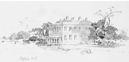
Former Fryston HallBuilt in the early 18th century, it was remodelled in the 1780s and demolished in 1931.
Stables [Grade II – NHLE 1135541]Built between 1726 and 1775, they are 100m northwest of the former hall.
Gardens and pleasure grounds
There was a small walled garden on the eastern side that was built at the same time as the hall c. 1719-21 and covered c. 1 acre. Leading from it to the river was a double avenue of trees (Figure 1). Surrounding it was the ‘Hall Garth’ of just over 6½ acres that was likely to be a pleasure ground. By 1775, the area ‘in hand’ near the hall had expanded to c. 57 acres and had been renamed ‘East Lawn’ (SA CM/1620), with the ‘West Lawn’ of c. 25 acres to west of hall (ibid). These may have been a mix of proto-parkland and pleasure grounds.
Following White’s plan, most of the area to the south of the hall that had been part of the ‘East’ and ‘West’ Lawns were incorporated into ‘Low Park’. The area to the north of the hall that had previously been part of the village was laid out as pleasure grounds and by 1838 covered 7½ acres, including the hall and stables (TNA IR 29/43/157). Within this area, there were freestanding greenhouses and by 1849, the plantation to the west and part of the old West Lawn were incorporated into the pleasure grounds (Figure 11). This latter area was later named ‘The Verandah’ and with the removal of the vicarage, the area now covered over 20 acres including the walled kitchen garden by 1890 (Figure 12).
Kitchen garden
The first kitchen garden, measuring ½ acre was built at the same time as the hall c. 1719-21 and was to the west of the hall across the public road (Figure 1). This had been removed by 1775 and a new garden of a similar size was in place just north of the hall (Figure 6). This continued to function as a productive area until the break-up of the estate in the early 20th century. By 1838, an additional walled kitchen garden (1¼ acres) and adjacent orchard (2¼ acres) had been built in the northern part of the village (Figure 11). These may have been part of White’s plan. As noted above, neither of these two areas had any glasshouses with these built in the pleasure grounds (Figure 12).
Park and plantations
Fryston ParkPut in as part of the plan by White between 1786 and 1790, it was divided into Low Park (121a) and Top Park (89a) by 1838. The western part is now a golf course and the eastern section has the A1(M) now running through it.
Park PlantationThe first part was planted between 1 October 1786 and 1 May 1788 to a design by White. 394,300 mixed trees were planted on 94 acres of land. By 1838, it had grown to 130a and later included 24½ acres of the former Old Field Plantation. In the late 19th century, the northern section of 28 acres was renamed ‘Whin Covert’ and used for game shooting. It remains largely intact with just some southern parts missing.
Green Quarry PlantationPlanted between 1786 and c. 1804, this covered 96a by 1838. Extant until mid-20th century, it is now covered by housing with the exception of the extreme northern section now named ‘Well Wood’ (17½ acres).
High Royds WoodPlanted between 1786 and c. 1804, this covered 81a by 1838. Extant until mid-20th century, it is now covered by housing.
Water
The estate is next to the River Aire, which forms the eastern boundary. In the southeast of the park was a small fishpond of just over 1 acre.
Books and articles
Hall, I. 1979. Samuel Buck’s Yorkshire Sketchbook. Wakefield, Wakefield Historical Publications.
Pope-Hennessy, J. 1949. Monckton Milnes, the years of promise 1809-1851. London, Constable.
Pope-Hennessy, J. 1951. Monckton Milnes, The Flight of Youth 1851-1885. London, Constable.
SAT 1790. Transactions of the Society for the Encouragement of Arts, Manufactures and Commerce, Volume 8. London, T. Spilsbury & Sons.
SAT 1791. Transactions of the Society for the Encouragement of Arts, Manufactures and Commerce, Volume 9. London, T. Spilsbury & Sons.
Turnbull, D and Wickham, L. 2022. Thomas White: redesigning the northern British Landscape. Oxford, Windgather Press.
YAS 1881. Rolls of the Collectors in the West-Riding of the Lay-Subsidy (Poll Tax) 2 Richard II., Wapentake of Osgodcrosse. Yorkshire Archaeological Journal 6, 1-44.
YAS 1892. Yorkshire inquisitions of the reigns of Henry III and Edward I, Part I (1241-83), Record Series Vol. 12. Leeds, Yorkshire Archaeological Society.
YAS 1896. Yorkshire Royalist Composition papers and Proceedings of the Committee for Compounding Vol III, Record Series Vol. 20. Leeds, Yorkshire Archaeological Society.
YAS 1900. Journal in 1718-19 of John Warburton. Yorkshire Archaeological Journal 15, 16-84.
Primary sources
Parliamentary Archives (PA)HL/PO/PB/1/1696/8&9W3n44 Private Act, 8 & 9 William III, c. 24 regarding estate of the late Roger Crowle, 23 March 1697
HL/PO/PB/1/1813/53G An Act for shutting up a Road and Footpath, leading from Castleford to Ferrybridge, in the County of York. 15 April 1813.
Sheffield Archives (SA)CM/1615a Survey and Valuation of Roger Crowle's estate at Fryston, 1783
CM/1620 Survey of Roger Crowle's estate at Ferry Fryston, 1775
The National Archives (TNA)IR 29/43/157 Tithe apportionment for Ferry Fryston, 15 March 1838
IR 30/43/157 Tithe map of Ferry Fryston, 1840
Royal Society of Arts (RSA)PR/MC/103/10/415 Letter from Thomas White to Samuel More, 2 February 1789
West Yorkshire Archive Service, Leeds (WYASL)WYL156/Map/45 Map of the Manor of Water Fryston 1726 (copy 1766)
WYL156/MX/54 Plan of an Estate at Water Fryston divided into lots for sale, 1819
WYL156/MX/446 Field books of Water Fryston, 1726
WYL156/MX/462 Draft agreement between Lord Pollington and William Crowle to exchange land in Fryston, 1763
WYL156/MX/486 Copy of deed of exchange between Earl Mexborough and William Crowle of Fryston Hall of closes of land in Water Fryston, nd (c. 1766 – 1774)
WYL156/MX/500 Letters from Joshua Wilson to William Crowle re lands in Fryston, 1757
WYL156/MX/561 Papers relating to tithes and rents in Water Fryston, 1782
WYL156/MX/563 Sale particulars of an estate at Ferry Fryston, 10 June 1819
WYL245/896 Feoffment from Richard le Walays to Lord William Vavasour of messuages and land in Friston-near-Ferrybridge, 2 Aug 1311
WYL245/983 Survey of Ferry Fryston [Dusthall estate], 1592
West Yorkshire Archive Service, Wakefield (WYASW)C162 Sale catalogue for Fryston Hall estate, 1904
QS1/140/4 Plan of roads near Fryston Hall (1800) for diversion of footpath, Apr 1801
Maps
Ordnance Survey 6” 1st edition, surveyed 1845 to 1849, published 1852
Ordnance Survey 25” 1st edition, surveyed 1890, published 1892
Ordnance Survey 6” revised edition, surveyed 1954 to 1965, published 1967
Ordnance Survey 1:25,000 [2½”] edition, revised c. 1969, published c. 1971
Figure 1 – Close-up of 1726 map showing the newly built Fryston Hall and surrounding gardens. WYAS Leeds (WYL156/Map/45). Note north is to the right.
Figure 2 – Sketch of Fryston Hall by Archibald Dickson, 2 February 1739/40. Yale Center for British Art (ref. NA7620.D53 D73 1736+), public domain
Figure 3 – Map of manor of Water Fryston copied from map of 1726, 1766. WYAS Leeds (WYL156/Map/45). Note north is to the right.
Figure 4 – Layout of Fryston Hall and immediate grounds from 1775 survey (SA CM/1620).
Figure 5 – Tithe map for Fryston and Ferrybridge, 1840 showing the plantations and parkland. © The National Archives, IR 30/43/157.
Figure 6 – Plan for the diversion of footpath through Fryston Park. West Yorkshire Archive Service, Wakefield (QS1/140/4).
Figure 7 – Fryston Hall estate on Ordnance Survey 6” 1st edition, surveyed 1845 to 1849, published 1852. National Library of Scotland CC-BY.
Figure 8 – Fryston Park estate showing housing on west from Ordnance Survey 6” revised edition, surveyed 1954 to 1965, published 1967. National Library of Scotland CC-BY.
Figure 9 – Fryston Park estate showing development of Ferrybridge power station to south from Ordnance Survey 1:25,000 [2½”] edition, revised c. 1969, published c. 1971. National Library of Scotland CC-BY.
. Note north is to the right.")
, public domain.")
. Note north is to the right.")
.")

.")


